
Suburbs and peri-urban areas refer to two territorial realities that are often confused, even though they encompass very different logics of settlement, mobility, and planning. The official zoning by Insee distinguishes these spaces according to their density and their functional link with the central urban hub, but the methodological revision of 2024 has reshuffled the cards by reclassifying some municipalities in the inner suburbs as “intermediate density.” Understanding this distinction requires looking at what the data actually measures.
Density Grid and Insee Zoning: What Separates Suburbs and Peri-Urban Areas in Statistics
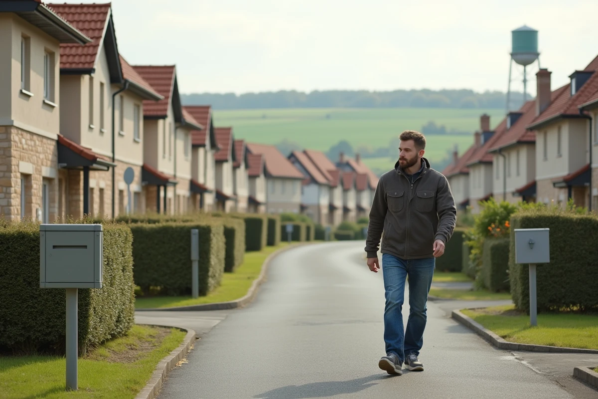
Suburbs, in the statistical sense, correspond to the municipalities of the urban unit that are not the central city. They are contiguous to the built fabric, integrated into the heavy public transport network (metro, tram, high-level service bus) and exhibit a continuity of built environment with the central hub.
See also : Understanding Hermaphroditism: Myths, Realities, and Testimonials on the Hermaphrodite fr Blog
Peri-urban areas begin where this continuity breaks. Peri-urban municipalities belong to the crown of an urban attraction area: a significant portion of their workforce works in the hub, but the built fabric is discontinuous, interspersed with agricultural or natural plots. To delve deeper into the criteria that underpin this distinction, a detailed file on the difference between suburbs and peri-urban areas specifies the associated stakes.
| Criterion | Suburbs | Peri-Urban |
|---|---|---|
| Continuity of Built Environment | Yes, attached to the urban unit | No, discontinuous housing |
| Density | High to intermediate | Low to intermediate |
| Public Transport | Structuring network (metro, tram, BHNS) | Poor service, car dependency |
| Car Dependency | Moderate | High |
| Dominant Form of Housing | Collective and small collective | Individual houses |
| Land Artificialization | Already largely artificialized | In progress, target of the Climate Law |
Read also : The Specifics of Dog Breeds: Focus on the Cane Corso and the Dogue de Bordeaux
The 2024 update of urban units and urban attraction areas by Insee has reclassified part of the inner suburbs of regional metropolises (Nantes, Rennes, Montpellier notably) as intermediate density spaces. This statistical shift blurs the boundary between the two categories and makes historical comparisons more challenging.
Mobility and Car Dependency: The Structural Gap Between Suburbs and Peri-Urban Areas
The dominant mode of transportation is the most tangible marker of the distinction. In suburbs, the proximity of a dense public transport network allows a significant portion of the workforce to forgo a car for their home-to-work journeys.
In peri-urban areas, the car remains the almost exclusive mode. The distances traveled are longer and alternatives are scarce. Since the energy crisis of 2022, several intercommunalities in the Île-de-France region and major metropolises (Lyon, Toulouse, Bordeaux) have been testing expanded social pricing for public transport targeting peri-urban residents: free park-and-ride facilities, combined train and bus subscriptions.
This institutional recognition reflects a clear observation: peri-urban areas bear a structurally higher mobility cost than suburbs. Households allocate a larger share of their fuel budget, making them more vulnerable to fluctuations in energy prices.
Consequences on the Budgets of Peri-Urban Households
The transport expense absorbs a significantly larger fraction of disposable income in peri-urban municipalities. Homeownership, often motivated by a lower price per square meter than in suburbs, is partially offset by mobility expenses.
- Two vehicles per household are common in peri-urban dual-income households, compared to one (or even none) in some well-served suburbs.
- The daily commute time regularly exceeds one hour round trip, compared to about thirty minutes for a suburbanite connected to the structuring network.
- The social pricing mechanisms tested since 2022-2023 explicitly aim to reduce this gap, but their deployment remains uneven depending on the mobility organizing authorities.
Land Artificialization and Climate Law: A Differentiated Impact Between Suburbs and Peri-Urban Areas
The Climate and Resilience Law of 2021, implemented by the SRADDET and PLUi since 2023-2024, sets a goal of zero net artificialization by 2050. Its impact is not evenly distributed between suburbs and peri-urban areas.
In suburbs, the land is already largely artificialized. There are opportunities for densification (elevation, conversion of brownfields, infill) and urban planning documents encourage them. Regulatory constraints weigh less on residential projects there.

In contrast, peri-urban municipalities still have reserves of agricultural or natural land. These are the areas primarily targeted by the trajectory to reduce artificialization. Peri-urban mayors face a direct trade-off: welcome new residents to maintain their tax revenues or preserve undeveloped land to meet quotas set by the SRADDET.
Land Tensions in Peri-Urban Crowns
The pressure is even greater as the demand for individual houses remains strong in these territories. Urban sprawl is progressing despite stricter regulations, and disparities between neighboring municipalities widen according to local urban planning choices.
Thus, peri-urban areas concentrate the majority of the conflict between residential development and environmental objectives. The already dense suburbs largely escape this land tension but must manage other issues (urban renewal, social diversity, infrastructure saturation).
Territorial Governance: Coordination Between Suburbs, Peri-Urban Areas, and the Central City
Suburbs generally belong to the same intercommunal structure (metropolis, urban community) as the central city. Planning, transport, and tax decisions are coordinated at the urban block level.
Peri-urban municipalities often fall under smaller community structures, with limited financial and technical resources. Coordination with the urban hub occurs through contractual mechanisms (reciprocity contracts, territorial balance poles) whose effectiveness varies significantly from one territory to another.
- Intercommunal PLUi allows for planning at the relevant scale, but its adoption remains incomplete in peri-urban crowns.
- The GART highlights the difficulty of financing regular transport lines to low-density areas.
- The social transport pricing policies tested by Lyon, Toulouse, and Bordeaux illustrate an attempt to respond, without a stabilized model at this stage.
The distinction between suburbs and peri-urban areas is not merely a question of distance from the center. It involves logics of density, mobility, land use, and governance that call for distinct planning responses. The statistical reclassification carried out by Insee in 2024 reminds us that these categories evolve with territorial practices, and that the boundary between the two remains as much a political as a geographical construct.